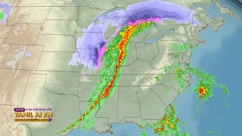
A historic and powerful "bomb cyclone" is currently battering the U.S. Midwest, bringing life-threatening blizzard conditions and record-breaking snowfall. In Green Bay, Wisconsin, meteorologists recorded 14.8 inches of snow, marking the city's third-snowiest day in over 130 years. Travel has been brought to a standstill across the Dakotas, Minnesota, and Michigan as visibility dropped to near zero in many areas.
As the storm system tracks toward the East Coast, over 100 million people are now under severe weather warnings, including threats of damaging winds and tornadoes. Major cities like Washington, D.C., Raleigh, and Richmond are on high alert for a fast-moving squall line expected to hit by Monday afternoon. Forecasters warn that the combination of heavy rain and intense wind gusts could lead to widespread power outages and significant flight cancellations.
In stark contrast to the freezing North, the U.S. Southwest is facing an "Extreme Heat Watch," highlighting a period of intense climatic extremes. Meanwhile, Hawaii continues to struggle with severe flash flooding that has submerged farmland and closed several major roads. These simultaneous weather events are stretching emergency response resources thin across multiple states as the week begins.